
Harvest was well underway in the dying days of August 2021 when I set out to walk the Yorkshire Wolds Way. The late summer weather had settled into a bleak humid grey which leached all colour from water and sky and dulled the gold and emerald fields to a pale beige and dusty green. Rarely was I engulfed in the restful silence of the deep countryside; instead my walk was accompanied by the roar of the combine and the hum of the granaries drying the crops after the wet summer. Late August and early September are probably not the best times to walk the Wolds Way as the chalk plateau of Yorkshire’s East Riding is perfect for cereal crops which leads to a monoculture landscape broken only by the deep and verdant dales.

But this walk was not about wilderness and the peaceful silence of more remote places. For over a year the recurrence of an old injury had hobbled me and this was a test walk to see whether a long distance trail was still possible. I’d decided to carry very little and rely on my long suffering husband for drop-offs and pick-ups. The 80 mile Wolds Way was perfect for this as it describes an arc inland from Hessle on the banks of the Humber, looping round to the North Sea at Filey. A base halfway allowed for easy access without long drives and gave the possibility of a ‘rescue’ if pain halted me. It turned out to be the perfect route.

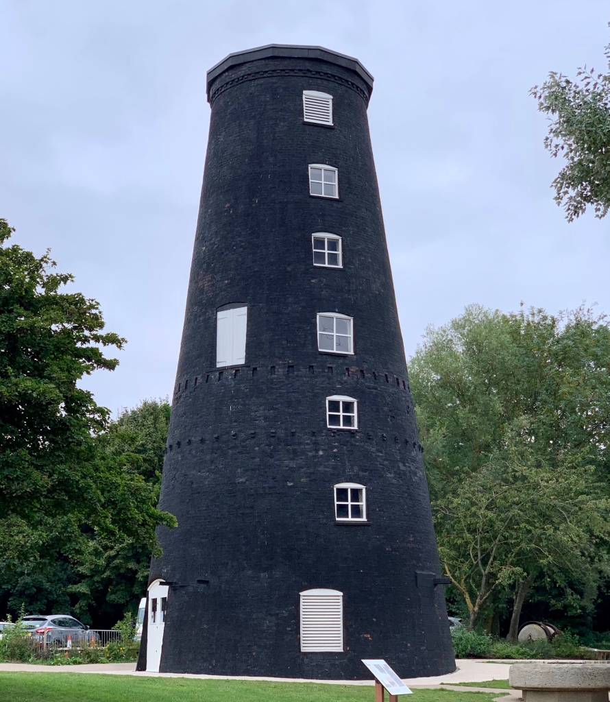
The elegant sweep of the Humber Bridge filled the view from the somewhat underwhelming start of the route. I picked my way through roadworks caused by the EU funded Tidal Defence Scheme, passing under the bridge and walking past a disused windmill in a country park. The windmill was black, painted with pitch to waterproof the bricks and prevent the grain and flour becoming damp. Beyond the park the path petered out into a choice between the beach and suburban roads. The beach is only accessible at low tide, and the tide was almost at its height, but I was sure it was ebbing and thought I could scramble the short distance to the bridleway beyond. Halfway I did wonder whether the loosely heaped rocks of the tidal defences would tumble into the sea carrying me with them, but I survived to reach the wooded track that led inland.
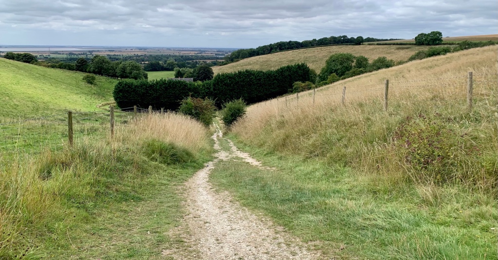
I was headed for South Cave and en route discovered a delightful church at Welton, perched above, and reflected in, a village pond which must have been dammed as it was higher than the village houses below. Opposite was a community cafe with the best lemon curd muffin I’ve ever tasted. Sadly the tea was served in a takeaway cup – I’ll be glad when crockery is back in regular use. Beyond the village the path entered Welton Dale, one of the many winding dry valleys gouged out of the chalk during the ice ages. In spring and early summer they must be filled with a riot of colourful wild flowers but few now remained. Above them lie the rolling wolds, low hills similar to the southern downs but less distinct and much lower. They, too, were once equally colourful meadows but are now given over to large arable farms.

Impressive churches are a feature of the area and Brantlingham church was particularly pleasant, placed some way beyond the village. It was the perfect lunch spot. The villages are mostly unremarkable and not chocolate box pretty. Most are brick built and surprisingly utilitarian compared to the brick and flint thatched cottages of other chalk landscapes such as Wiltshire and Hampshire. Perhaps the lack of flint contributed to this or maybe the now long gone industrial wealth of the region encouraged the building of new houses for farm workers, whereas the relative poverty of the south during the same period unintentionally preserved the older cottages in villages. Certainly this area is not now as prosperous as the southern counties, but it has its own charm.

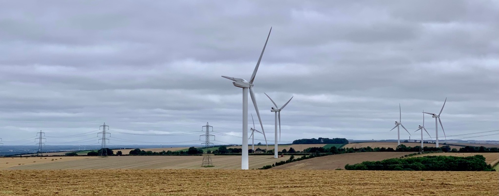
By South Cave I realised that I was walking well and reluctant to stop, so continued to an obscure crossroads amongst rolling fields, some seventeen miles from the Humber. The following day an early start took me north along broad dales filled with sheep, past wind farms and fields of wheat and barley stubble with the occasional clump of vibrant wild flowers, a welcome punctuation amidst the rather tedious beige. I was surprised at my speedy progress given how uncomfortable my low back had been even recently. After a year of working with osteopaths, physios and a personal trainer I was wondering whether I would ever recover but careful management of my posture and gait were allowing me to walk well. The easy ground and gentle inclines definitely helped and I would recommend this route as an easy introduction to long distance walking.
The pub at the well kept village of Goodmanham served an excellent pot of tea and a rather dry slab of cake for a morning snack. Shortly after Goodmanham the path passed through Londesborough Park with its delightful little estate village and church. This was the prettiest village along the route although other nearby estate villages such as the one close to Sledmere House were also attractive.


Although the weather was overcast it had remained dry until the outskirts of Nunburnholme where the skies suddenly darkened and another old church gave me lunchtime shelter from a brief squall. Inside the church there was a tall intricately carved Anglo-Saxon cross shaft with later Viking carved additions which I studied as I ate my butties. Beyond the church the trail crossed more of the deeply incised dales. They are very distinctive, writhing like green snakes between the rolling fields of the plateau. Often there were cattle or sheep grazing the fertile slopes as once there would have been in the fields above. This region grew rich and powerful in Medieval times off the proceeds of the sheep trade.

Yet again I was walking faster and further than anticipated. Close to Huggate, my intended finish, I made the decision to continue on to Fridaythorpe, pushing on into the late afternoon and racing the rain. Nearly twenty five miles after I set out from a bleak and windswept crossroads I reached the main road and the welcome sight of a familiar car. I was amazed and concerned in equal measure: would I be able to continue walking the following day? The answer was yes, but a half day seemed sensible so nine miles along and above Thixendale, the most attractive of all the dales, brought me to the abandoned Medieval village of Wharram Percy with its picturesque ruined church. The villagers were evicted in the 16th century to make way for sheep as happened in the Scottish Highlands. That afternoon we visited the Minster town of Beverley where the profits from the sheep could be seen in the fabulous Minster church, the ornate market cross and the large town houses. Sleepy rural Beverley was once the tenth largest town in England and one of the richest.


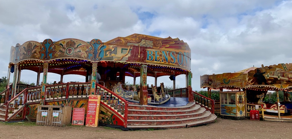
By now all the fields were beginning to blur into one. Leaving Wharram-le-Street the next day the trail led me along broad chalk tracks past dusty stubble, scrubby woodland and windswept farms with massive barns. The grey skies and humidity shrouded distant views in a murky haze. There was little of much interest to draw the gaze although the decommissioned church at Wintringham was worth a wander inside for the strange Biblical quotations painted on its walls and the ancient bier with a wooden handle and iron wheels. There were green men and dragons carved on the choir stalls. The day became a bit of an eighteen mile drudge trudge along the top of a north facing escarpment above a broad flat valley. Had there been clear skies and distant views it could have been lovely but the day was enlivened only by a steep and slippery climb up to a beautiful gate close to a disappointing sculpture, and a very unexpected funfair beside a maize maze where I bought a snack and welcome cuppa. I was very ready to be collected from the verge when I reached the road at Staxton Wold Farm. However it was now only a half day’s walk to reach the sea.


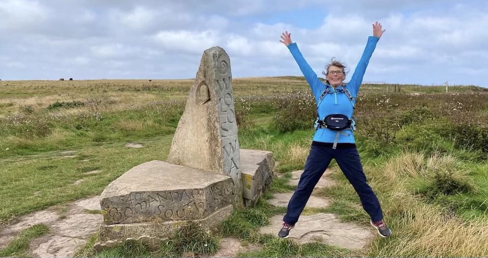
Staxton Wold is the site of RAF Staxton (Remote Radar Head Staxton Wold). From as early as 3AD the site has been used for warning beacons and in 1937 it was chosen as the location for the first radar station. It is still in operation today. The trail passes its steel towers and razor wire fences then crosses harebell filled dales, descending and ascending rather than following along them. This made for some steep little climbs until finally I could see the cliffs of Flamborough Head and the sea. After the village of Muston and a long road stretch through suburban streets I reached the shabbily attractive sea front at Filey. The clouds had parted and blue skies appeared to celebrate the end of the walk. I wandered along the promenade and onto the beach to dip my toes in the sea before climbing up to the cliff top and strolling along Filey Brigg. It was a delightful end to a good walk. Three and two half days to cover eighty miles proved that recovery was possible despite the time it had taken. Maybe I’m learning patience at last.


This is definitely not a rugged route. The gentle slopes and easy ground were perfect terrain to test myself on. Navigation is not a problem as the trail is well signposted but it does feel remote inasmuch as there are few habitations along the way. I saw very few people after the first day despite it being the Bank Holiday week. One local dog walker complained that too many people were walking the trail since the start of the pandemic but I rarely saw a soul. I enjoyed it, particularly the chance to see a new area after the restrictions of the pandemic, but I don’t feel the need to return.


Interesting and well written account Lizzi!
LikeLike
Thanks Chris. It was good to be back on the trail again.
LikeLike
So pleased you are back out & managing the trails again Lizi. Lovely blog, you brought your walk alive…x
LikeLike
Thanks Jen. It’s been a long time but I’m back on my feet again 🙂
LikeLike
So so happy for you…🤗
LikeLike
I enjoyed reading this, Lizzi. You pulled me into the walk. Excellent too, that your body held up well. 👍
LikeLiked by 1 person
Thanks. I’m really pleased to be back on my feet – at last!
LikeLike